Park Groot Schijn
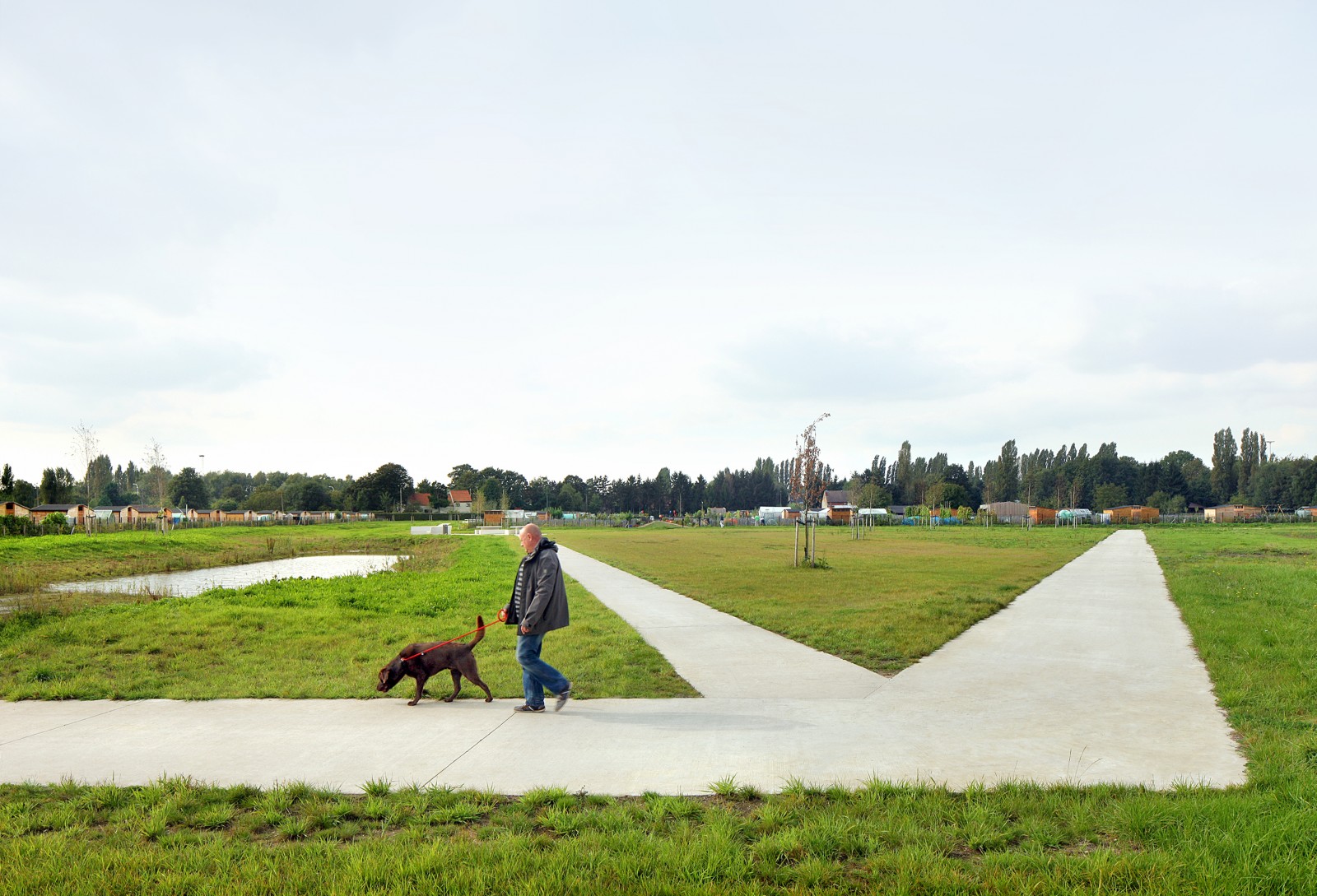
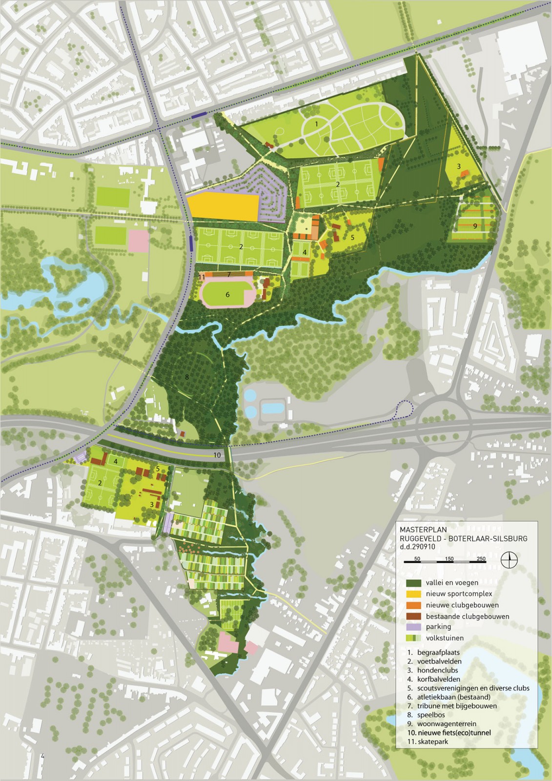
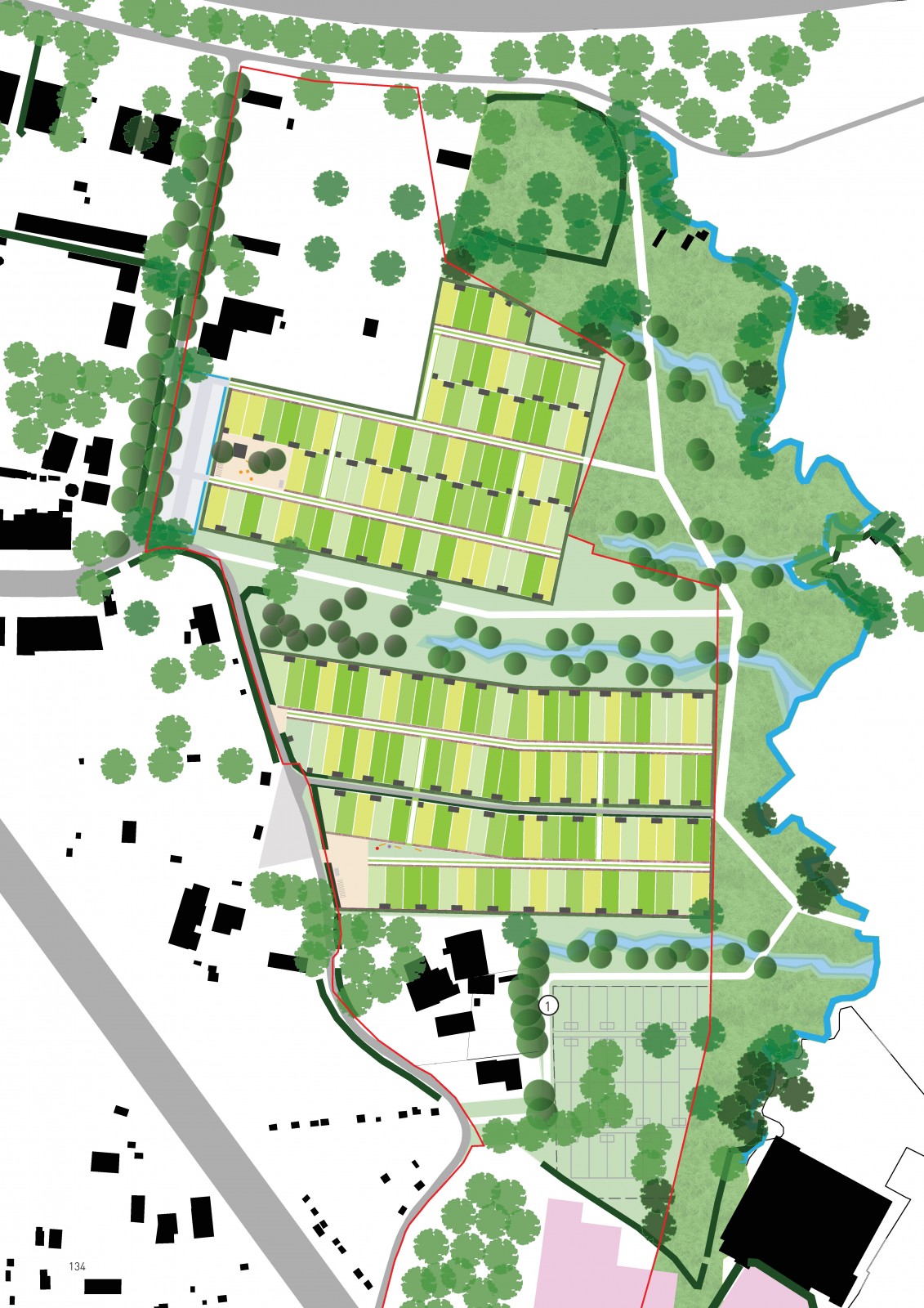
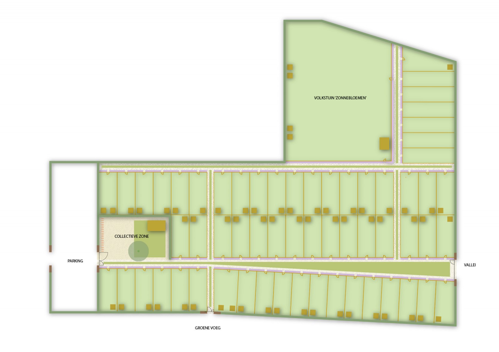
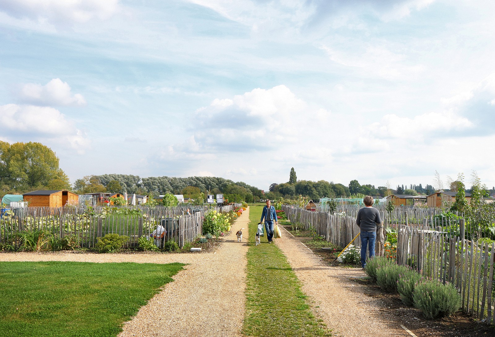
Park Groot Schijn is one of the largest open spaces in the city of Antwerp, well known for its vibrant associative life. The area is bordered by busy roads, commercial facilities and a densely populated residential area. When we started the assignment to make a masterplan for this area, the open space was chaotically consumed by dozens of clubs and associations: a ski club, ice skating hall, 150 garden allotments, dog training clubs, soccer and korfball fields, scouts, ...
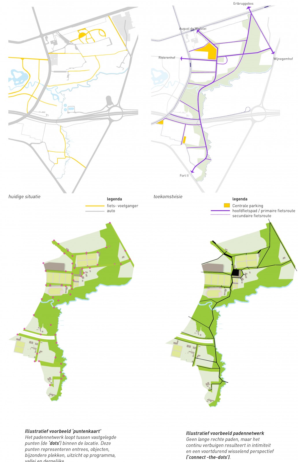
The goal of the master plan was to introduce a new spatial structure for the park, while retaining the existing users. An extensive participation process was set up in which all those involved would have a say. In the first phase, the participation process focused on the mapping of the existing situation and the dreams of the different actors, in the second phase we developed the program and the spatial layout of the park. To give the park a new structure, we introduced a tissue of Green Joints: as offshoots of the valleys of the Groot Schijn and Koude Beek, these Green Joints stretch the nature and the atmosphere of the valleys to the park edges, while surrounding the clustered recreational program.


Location:
Deurne, Antwerp
Project:
Park Groot Schijn
Year:
2009 - 2014
Phase:
masterplan + landscape design phase 1
Client:
AG Stadsplanning Antwerpen
In collaboration with:
Masterplan: 1010au in collaboration with Maxwan, Karres&Brands. Park phase 1: 1010au in collaboration with Maxwan, Antea.
Publications:
http://www.landezine.com/index.php/2015/05/park-groot-schijn-by-maxwan-architects-urbanists/ https://www.vrp.be/post/planningsprijs-2010 https://www.warhorse.be/filter/Book-Design/Park-Groot-Schijn